{gallery count=1 alignment=right width=240 height=240}travels/velebit/north/zavizan_2015-02-11/medium/DSC06146-023.jpg{/gallery}
Route: Oltari (950 m) - Mt. Lodge Zavižan (1594 m) - Oltari
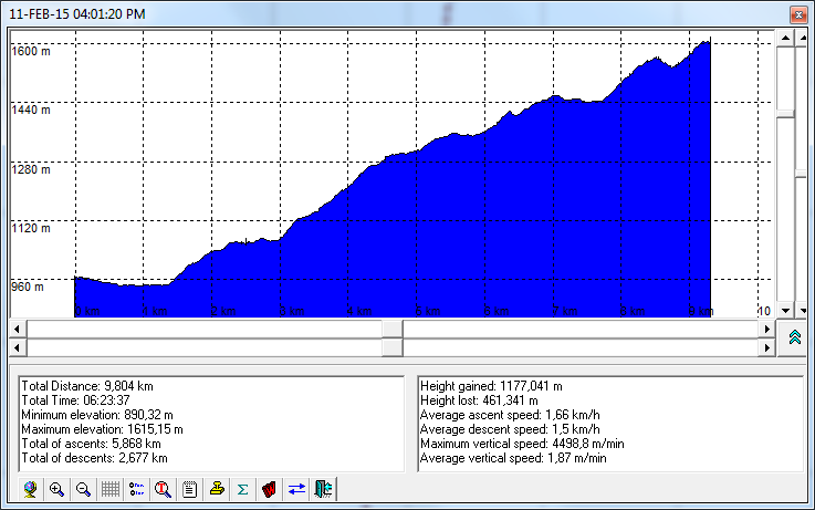
Atitude difference: ~650 m (altitude profile is here)
Starting and Ending point: Oltari (950 m) - (the village on the road Otočac - Švica - Krasno - Sv. Juraj)
Acent time: 6 h (Descent time 4,5 h)
Difficulties : very difficult because of winter conditions (138 cm of snow, officially)
Oneliner: Real winter ascent to Zavižan - there was about one meter of snow along the whole trail. We fulfilled the promise given to ourselves at the previous ascent to Zavižan (Winter Ascent to Zavižan in December 13-14, 2014) - "We shall return - in winter conditions".
{gallery count=1 width=150 height=150}travels/velebit/north/zavizan_2015-02-11/medium/DSC06017-002.jpg{/gallery}
Members of the group: Marijan, Saša and Dražen from HPD Zrin Hiking Club
Notes:
- It was beautiful to walk on one meter of virgin snow and enjoying silence of the Mt Velebit. The good atmosphere is boosted by pleasant housekeeper Ante and the absence of the crowd (what is impossible during weekends, even in winter period).
{gallery count=1 alignment=right width=150 height=150}travels/velebit/north/zavizan_2015-02-11/medium/DSC06090-010.jpg{/gallery}
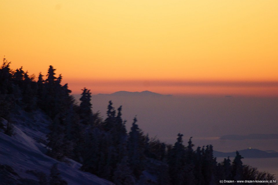
- the beautiful weather has given a very rare view to Apennines from Mt Velebit (they are about 250 km far)
{gallery count=1 alignment=right width=150 height=150}travels/velebit/north/zavizan_2015-02-11/medium/DSC06165-029.jpg{/gallery}
- There was 138 cm of snow, officially and about one meter in the forest. Under these conditions, the trail is non-passable without snow-shoes or back-country skies.
{gallery count=1 alignment=right width=150 height=150}travels/velebit/north/zavizan_2015-02-11/medium/DSC06187-034.jpg{/gallery}
- The road was by chance clean more then half way but it could stay for very short time due to bora, and fresh snow.
{gallery count=1 alignment=right width=150 height=150}travels/velebit/north/zavizan_2015-02-11/medium/DSC06211-042.jpg{/gallery}
Photo-album: Photoalbum by Dražen
{gallery count=1 alignment=right width=150 height=150}travels/velebit/north/zavizan_2015-02-11/medium/DSC06314-056.jpg{/gallery}
Maps and GPS data:
- Nacionalni park Sjeverni Velebit, Map No 16a, M 1:30.000, SMAND d.o.o., Varaždin, 2005.
- Sjeverni Velebit, Map No 16, M 1:30 000, SMAND d.o.o., Varaždin 1995.
- Topographics map TK25 Rab-2-4 (418-2-4), M 1:25000, Državna geodetska uprava, Zagreb
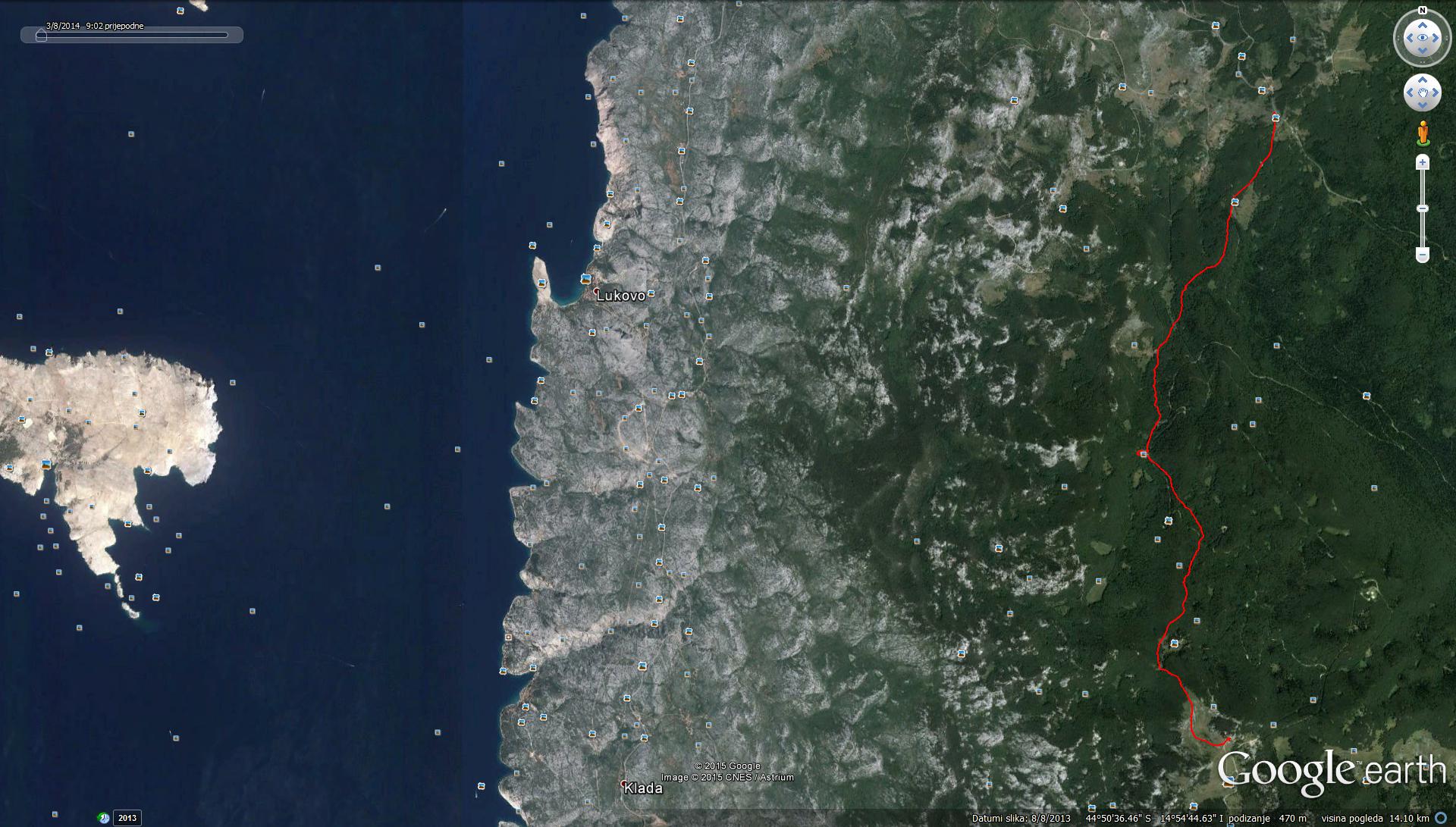
- KML file with GPS tracks
- In order do view GPS tracks in GoogleMaps
 application click on the map icon;
{gallery count=1 width=150 height=150}travels/velebit/north/zavizan_2015-02-11/medium/DSC06275-052.jpg{/gallery}
Accommodation: